
Goblin Valley State Park, Utah - October 6th to 10th, 2024

As Season Six was winding down, we had one more state park to visit, Goblin Valley State Park in Utah. It was the third Utah state park we’ve visited this season. We must say that Utah has some spectacular state parks and Goblin Valley is one of the best.
Sunday was a short driving day, just an hour and a half, from Fruita Campground in Capitol Reef National Park to Goblin Valley State Park, both in Utah. Before we left Capitol Reef, we stopped at the Gifford House to get two more pies.

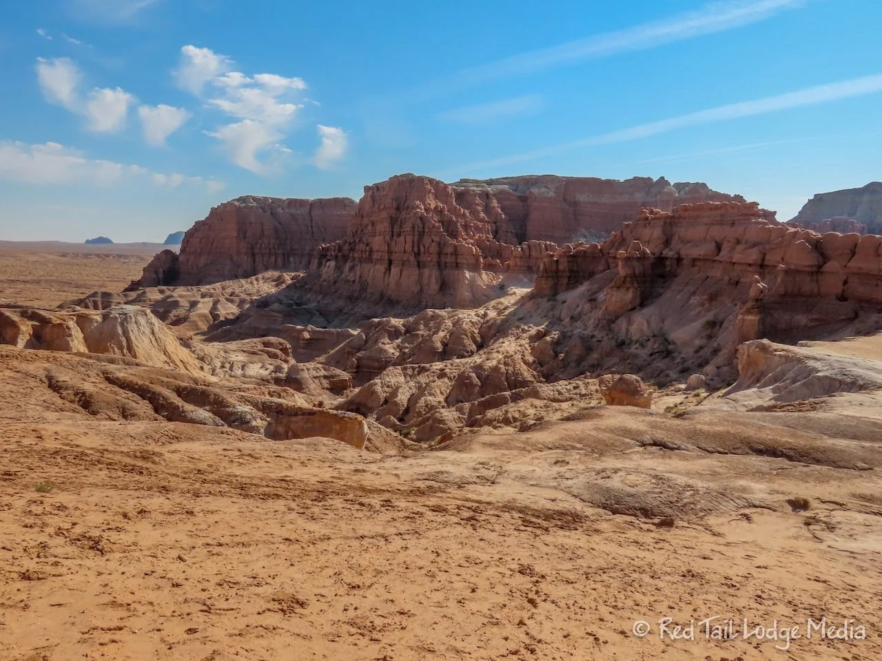
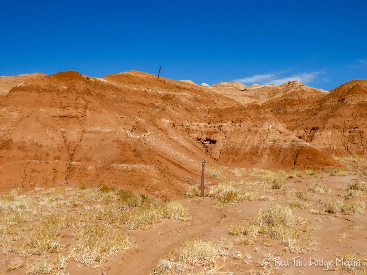
The drive over to Goblin Valley goes through such a varied landscape. We’ve driven the stretch from Capitol Reef to Hanksville several times before. But some of the surroundings still look surreal and bizarre, like from another planet.
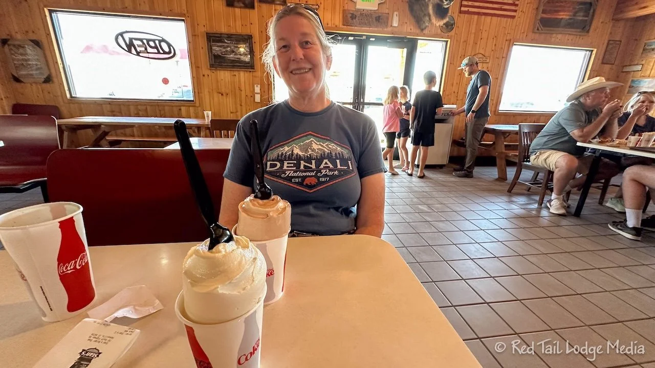
We stopped in Hanksville for lunch and gas. Stan’s Burger Shak sounded interesting, so we gave it a shot. We both got the Hankburger. Keith got the Duke fries (tater tots filled with cheese and jalapeno) while Ann had the cajun fries. The combo came with a shake. Their shakes are so thick that it extends a couple of inches above the rim of the cup. We’ve come to the conclusion that shakes in the state of Utah are more like soft serve ice cream that you eat with a spoon, as opposed to the milk shakes we are familiar with that you drink with a straw. The food was OK, but it was a cute atmosphere. We enjoyed reading all the funny signs hanging on the walls.

It was early afternoon by the time we were setting up at camp in Goblin Valley. The small campground is nestled up against some interesting rock formations. Each site has a picnic table with a nice shade structure, a welcomed feature in the desert.

Before dinner, we decided to go on a short hike, right from the campground. The Curtis Bench Trail led us a mile over to a point overlooking the Goblin Valley. Goblins are hoodoos and the valley is full of them.

When we returned to the campground, there was another EKKO camped there. So we met the owners, Doug and Jan from Texas. We had a lovely chat, exchanging stories and ideas about our rigs. We love meeting other EKKO owners. One of these days we need to go to an EKKO meetup.

Monday we explored the goblins or hoodoos. First we rode our bikes over to the main parking lot, then we explored from there.

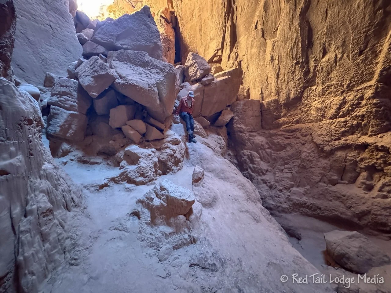
Stairs lead down from the parking lot to Valley 1. There is no real trail, you just wander around among the goblins. It wasn’t long before we reached a sign that indicated we were in Valley 2. After we got our fill of goblins in Valley 2, we saw a sign pointing towards Valley 3 and Red Canyon. It looked like you just followed a dry wash, so we let it lead us on.
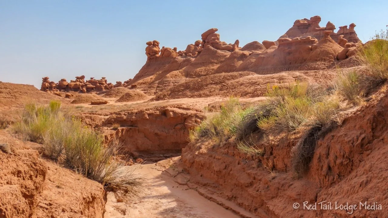
While Valley 2 is adjacent to Valley 1, Valley 3 is not. After walking along the dry wash for a mile or two, we reached Valley 3. The density of the goblins in Valley 3 is not as high as the first two valleys. However, we’re not sure if we reached the end of Valley 3, as we stayed in the dry wash. We were about half way through our water and needed to start heading back.

If you venture out to Valley 3, we recommend that you have a GPS tracker with you. Even though Valley 3 is not far, the dry wash winds around and you can easily lose your sense of direction. The dry wash we were following joins another wash with a small sign and a sign indicated to turn down a side wash right before reaching Valley 3, but otherwise, the trail is not marked. It would be easy to miss the turn on the way back where the two washes joined together.

If you are just wandering around Valleys 1 & 2, it is harder to get lost because you can see the parking area easily. By the time we returned to the parking area, we had gone 5.4 miles with an elevation gain of 194 feet which we covered in about two and a half hours. It was our 71st hike for the season.

As we were hopping back onto our bikes, we could see a dense haze out over the landscape that looked like it was from wildfire smoke. A faint wildfire smoke smell in the air confirmed our suspicions. Where not sure where the fire was located, it could be hundreds of miles away. The smoke could have been from the Yellow Lake fire up near Salt Lake City, about 200 miles to the north. By evening, the wind must have shifted and the air had cleared. The was the first time that we remember seeing wildfire smoke this season. So, despite being a pretty active wildfire season, we’ve managed to miss it on our travels.
Tuesday, we rode our bikes again over to the main parking lot and went on a different hike. This time we were on a marked trail, the Goblin’s Lair. The trail circles around to the back side of the ridge line on the south side of the goblins. The Goblin’s Lair is a cave.

As we started our hike, we realized we didn’t bring any headlamps with us. It turned out that we didn’t need any. The cave is not really dark since it has several skylights overhead. In fact, you can repel down from one of the skylights into the cave, but that requires a permit (along with skills and equipment that we don’t have).

The last little steep section up to the cave is rather sketchy, but more so on the way back down than the way up. We took it slow and didn’t have too much difficulty. However, Ann did crab walk a short section on the way back down. She probably could have made it standing up, but she felt safer crab walking. If her feet slipped while on her hands, she wouldn’t fall and get hurt.
Once you reach the mouth of the cave, there is a short rock scramble to get down into the cave. Even though it was more technical than the steep switchbacks up to the cave, we were more comfortable with the rock scramble as there wasn’t the fear of slippery footing.
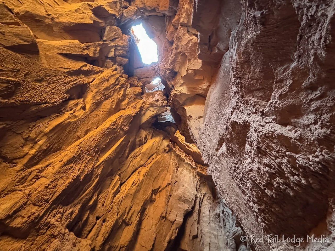
The cave is not very big, but it is pretty cool. The cave is in the side of the cliff, with erosion making interesting formations inside the cave.

At the Goblin’s Lair, there is a sign indicating the Goblette’s Lair is only a quarter of a mile further down the trail. So we continued on. The Goblette’s Lair is a smaller version of the Goblin’s Lair. It was the same deal with a steep trail up to the cave and a rock scramble down into it. Be sure to go all the way to the top of the trail, because there is an even smaller cave just below the Goblette’s Lair.

By the time we returned to the trailhead, we had gone 3.3 miles with an elevation gain of 413 feet which took us almost two hours to complete. It was our 72nd hike for the season. Even though it was a short hike, the rock scrambling made us feel like we had a good workout.
We biked back to camp and ate lunch. Afterwards, we hopped on our bikes again to check out the Visitor Center. When we got there, we found out that it was closed that day for staff training. Thank goodness it was not far, so we didn’t waste a lot of time.

Wednesday we went for another hike. This time we started right from the campground. We believe the route we took is called the Grand Circle Trail, but there are no routes in AllTrails nor on the state park web site to confirm the full route. Just part of the time we were on a trail called Grand Circle Trail.

From the campground, we took the Entrada Canyon Trail over to the main parking lot. The trail meanders along a dry wash among eroded mounds.
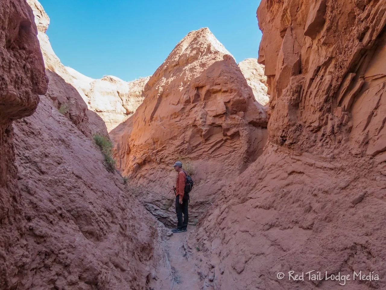
From the parking area, we took the Carmel Canyon Loop Trail, following the other half of the loop that we didn’t do the day before, the part that isn’t part of the Goblin’s Lair Trail. This half of the trail follows a narrow canyon with some tricky sections, as there are some pretty narrow areas with some steep step ups. Nothing was too difficult, just challenging enough to make it fun. We were going downhill, which probably made it a little easier, but most people were going the opposite direction. They were helping pull each other up in some areas.

A little side spur trail brought us up to the Three Sisters rock formation, then we returned to the Carmel Canyon Trail.
Where the Carmel Canyon Trial rejoins the Goblin’s Lair Trail, we continued a little ways on the Goblin’s Lair to reach the Grand Circle Trail leading over to the Visitor’s Center. After climbing up to the top of some badlands, the trail is rather exposed as it crosses the open desert to the Visitor’s Center. However, the temperatures were in the 80’s and a cool breeze kept us comfortable.
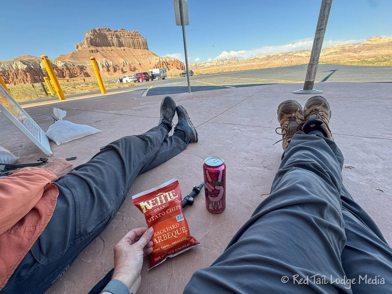
This time the Visitor’s Center was open. Inside are a few displays, a gift shop, and a very limited variety of refreshments. They didn’t have soda, so we were forced to drink something more healthy, like Peace Tea. Keith got the tea and lemonade flavor while Ann drank the Razzleberry. For electrolytes (yes, that is the excuse we’re going with), we each had a small bag of BBQ potato chips. The only place provided to sit down outside was one picnic table out in the full sun. Instead, we opted to sit down on the side walk, leaning up against the building in the shade, to enjoy our treats.

From the Visitor’s Center the Grand Circle Trail continues for another half a mile to reach the campground. Upon returning to our camp site, we had covered 3.8 miles with an elevation gain of 302 feet which we completed in two and a half hours. It was our 73rd and last hike for the season.
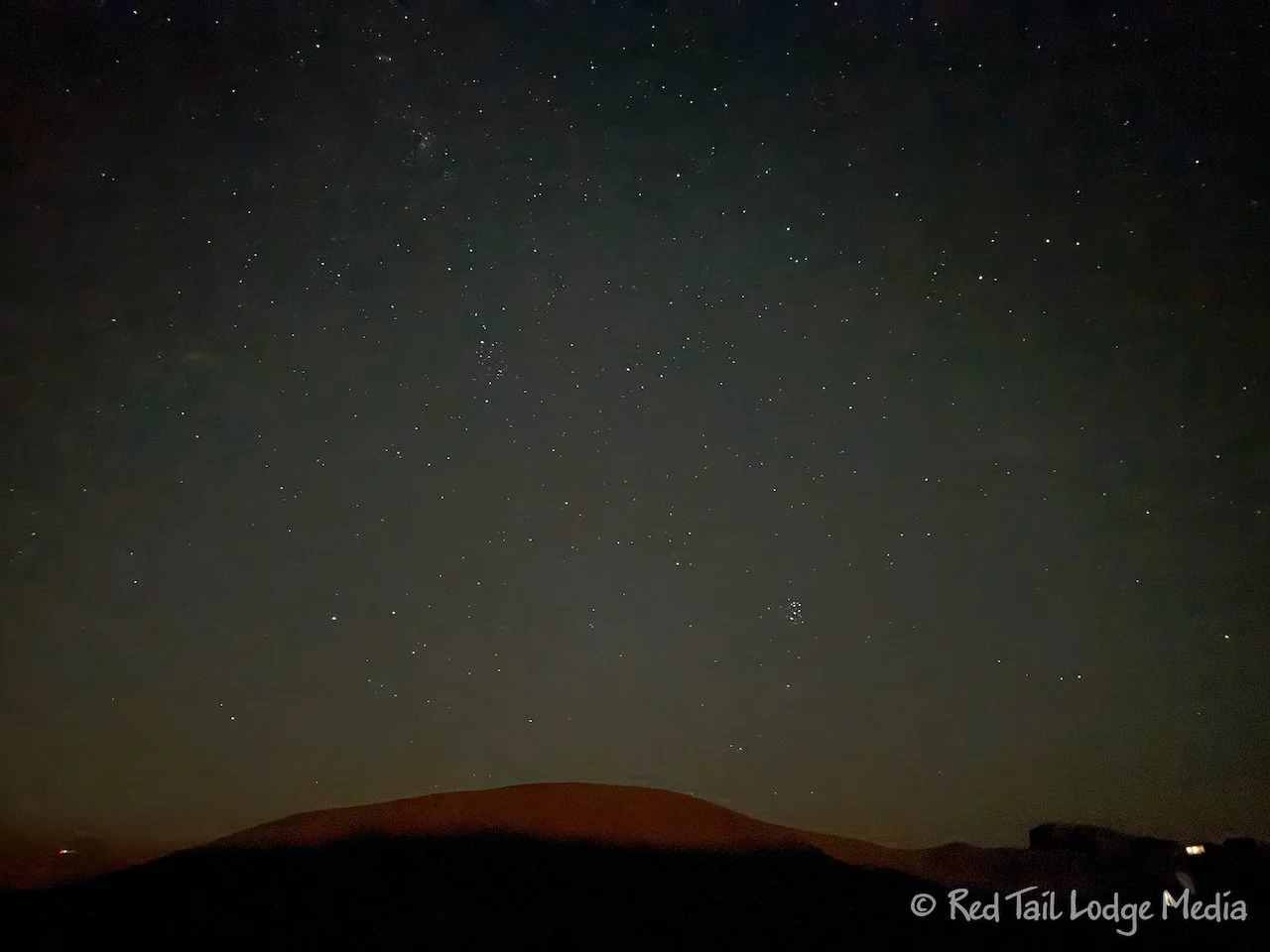
As it was our last night in dark sky territory for the season, we decided to stay up for a little bit and venture outside after dark to see the stars. Although we could make out the Milky Way, the moon hadn’t set yet, so we couldn’t see as many stars as we were hoping to. We guess we need to do that more often. Next time.

Thursday was our drive home. We dumped our tanks before we left Goblin Valley State Park. We did not fill our fresh tank as our camping for the season was over. We ended the season pretty similar to the way we began it, by driving I-70 through the Rocky Mountains.

Just like before, we stopped at Love’s in Grand Junction for gas, drinks, and a bathroom break. Then stopped again in Avon for lunch. This time Loaded Joe’s was open, so we ate there instead of at Ein Prosit where we ate in the spring (Colorado National Monument Revisited - May 1st to 2nd, 2024). Construction along I-70 lengthened our drive by an hour or so.

As we emerged from the mountains, we could see the all-too-familiar haze of wildfire smoke from the fires in Wyoming and Idaho. But the trees on the plains greeted us with their fall colors. Even though we love to travel, it felt good to be back home.

And so ended Season Six. Goblin Valley State Park was a nice ending to the season. Now we had a short stay at home while we get ready for Season Seven. Stay tuned for more adventures.
Check out our related video: Goblin Valley State Park, Utah
(Ann)