
Yosemite National Park - North - September 7th to 10th, 2024
Yosemite National Park is a very popular park. It can be tricky to get campground reservations inside the park, but we managed to snag reservations at two less popular campgrounds outside of Yosemite Valley the minute the reservations opened up. We stayed three nights in Wawona Campground south of Yosemite Valley and four nights in Hodgdon Meadow Campground north of Yosemite Valley. The previous post covered our time in the Wawona Campground, concentrating on the southern part of Yosemite, including some of our time in Yosemite Valley. This post covers our time in Hodgdon Meadow Campground, concentrating on the northern part of Yosemite with some more time in Yosemite Valley.
Saturday morning we checked out Tuolumne Grove. This is one of three Sequoia groves in Yosemite. We hiked Mariposa Grove the previous Wednesday. The third grove is Merced Grove, but it was closed during our visit in Yosemite.
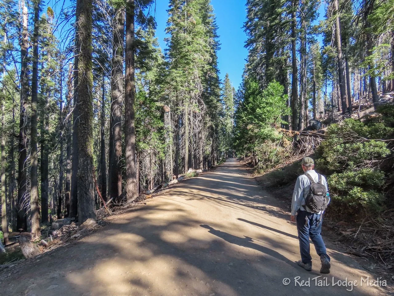
The Tuolumne Grove is smaller than Mariposa Grove. There is really only one trail through the grove. From the parking lot, it is about 2.5 miles round trip, but it is steep, with an elevation gain of 500 feet. The trail down to the grove is somewhat paved. It is part of the historic Old Big Oak Flat Road built in the 1880’s to carry travelers to Yosemite Valley. The trail continues past the grove on the road all the way to Hodgdon Meadow Campground. So we could have hiked right from the campground to the grove. However, it is 4.5 miles between the campground and the grove, each way. We decided to drive to the trailhead instead, not wanting to spend all day just to see the grove.
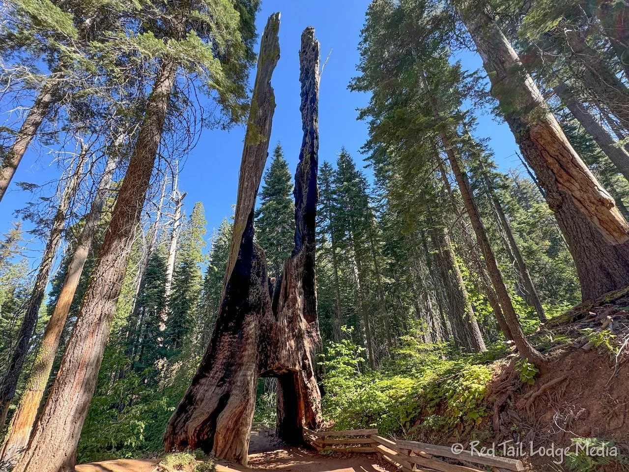
There are about 25 mature Sequoia trees in Tuolumne Grove. There are interpretative signs along the half mile loop through the grove. The Tuolumne Grove, just like the Mariposa Grove has a tree with a tunnel carved out of it. However, the one in Tuolumne Grove was augered through a dead burned out stump instead of a live tree. It is called the Dead Giant Tunnel Tree.

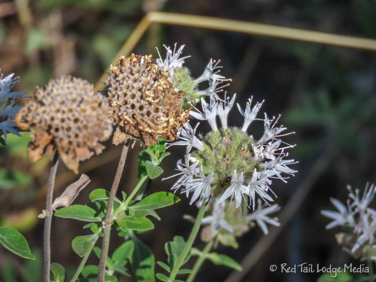
Just like we saw in Sequoia National Park (Sequoia National Park Revisited - May 23rd to 30th, 2024), there were a lot of dogwood trees in the grove. It was nice to see them during a different time of year. It was spring when we were in Sequoia National Park and the dogwoods were in bloom, with their wonderful white flowers. It was now the beginning of September, so the dogwoods in the grove no longer had blossoms, but had red and pink seed pods where the flowers used to be.

There were also a lot of berries. Other visitors along the trail helped us identify elderberry and gooseberry. We also saw some red berries that could have been red huckleberry.
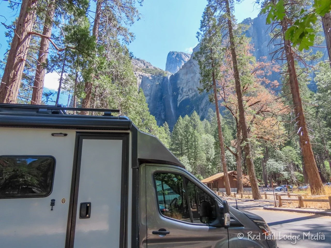
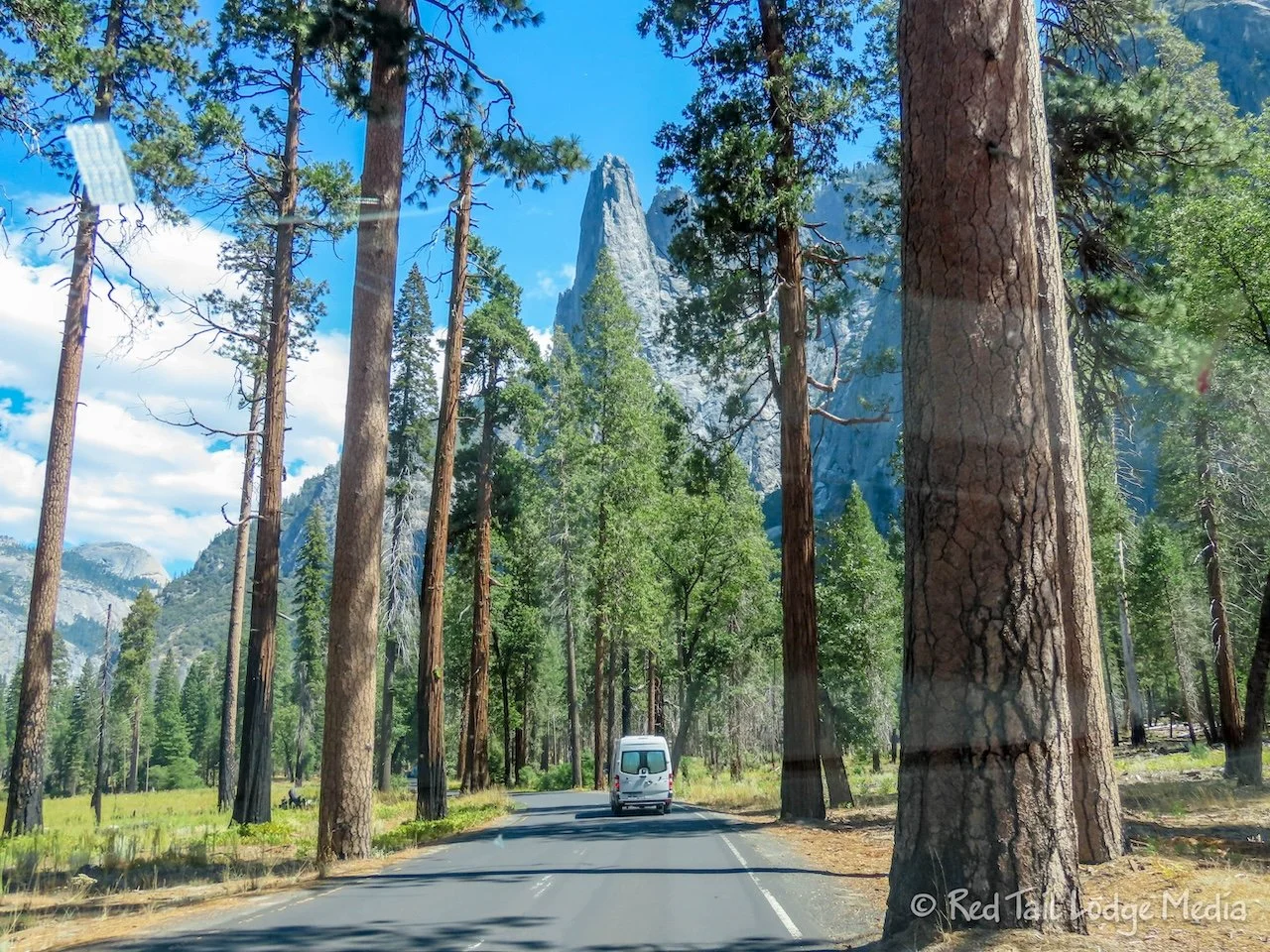
From Tuolumne Grove, we drove down to Yosemite Valley. When we reached the valley, we went straight to the parking lot for Bridalveil Fall. Being a Saturday, we weren’t sure if we would get a parking spot there. The lot was busy, but we had no problems. People were coming and going all the time. This was the first weekend after Labor Day weekend, and visitation in the park was lower than normal.

After enjoying our lunch in Red Tail (our Winnebago EKKO), we checked out the falls. You could see the falls right from the parking lot. A short quarter mile trail led over to a couple of closer viewpoints of the falls. However, they were not necessarily better than the view from the lot. It was midday and getting closer to the falls meant you were looking right up into the sun.
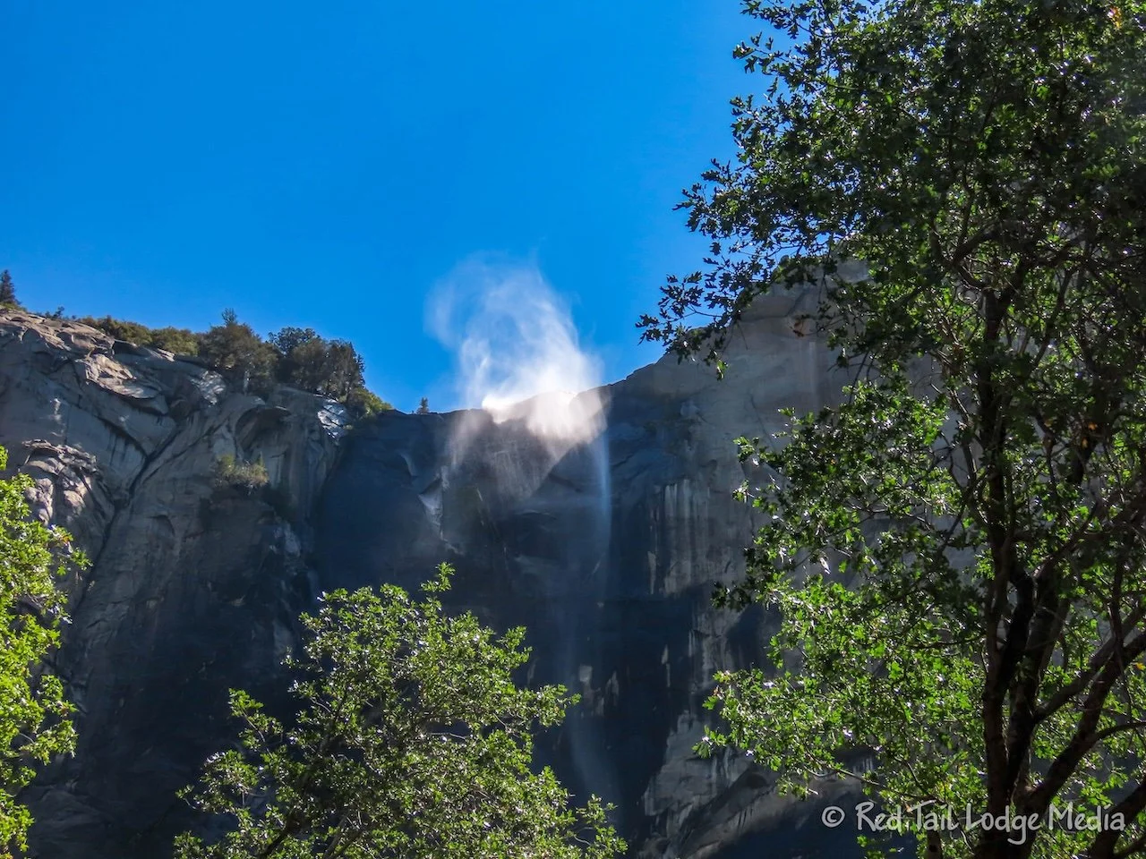
Unlike Yosemite Falls, Bridalveil Fall (as well as Vernal Falls and Nevada Falls that we saw the previous day) flows year round. However, we’re sure the volume of water flowing over the falls is much less in the autumn. While we were there, the top of the falls were being blown around by the wind, turning some of the water into a misty cloud. We’re not sure the water fall behaves that way all year round. It was pretty cool to see.
From there, we drove over to the Day Use parking area near the Yosemite Valley Lodge. Again, even in the afternoon on a Saturday, there were still plenty of empty spaces to choose from. We had dinner reservations for 6 pm at the Yosemite Valley Lodge Mountain Room. Having several hours to kill, we wandered around a little to check out the area.
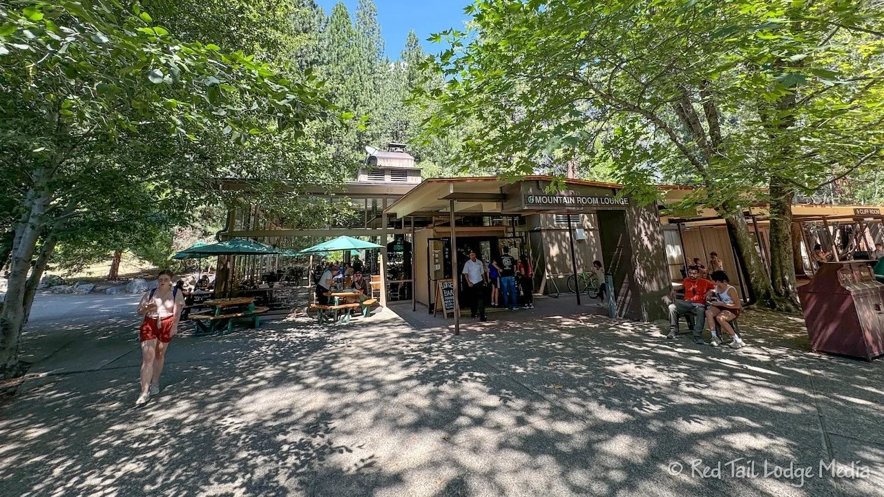
The lodge itself seemed like it was a series of two story buildings nestled in the trees. The Mountain Room was in a group of buildings with other services, such as the Basecamp Eatery (fast food), the Mountain Room Lounge, and a gift shop.

From Yosemite Valley Lodge, we walked across the meadow over to Yosemite Village. The village had more attractions, like the Welcome Center, the Village Store, the Village Grill, the Ansel Adams Gallery, the Yosemite Exploration Center, as well as the Yosemite Museum and Indian Village. The Village Store was larger than the gift shop at the lodge, with a larger selection of groceries and souvenirs. Unlike the other stores in the park, the Village Store had Coke in addition to Pepsi. Yay! So we picked up a couple of Cokes along with a couple of It’s It for our mid-afternoon snack. Keith bought a hat in the Welcome Center while Ann picked up a T-shirt in the Village Store. We checked out the Yosemite Exploration Center but then we reached our limit of exploring and decided to head back to Red Tail to relax before dinner. Instead of walking back, we took the free park shuttle.
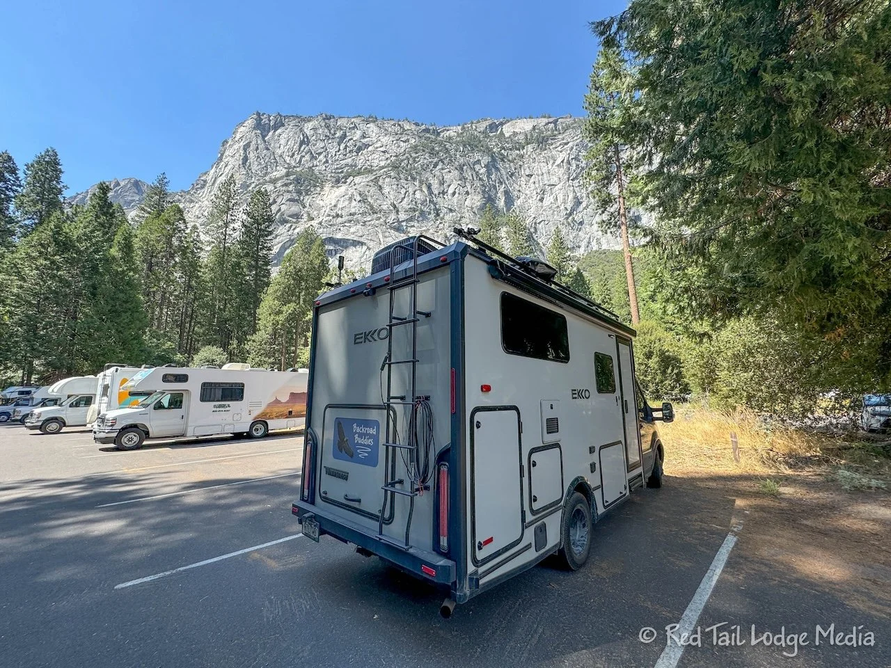
It was a little warm out, probably in the 90’s. Even though we parked Red Tail in the shade, we decided to turn on the air conditioner. We hadn’t run it in quite a while and it is good to run it every now and then. Our batteries were fully charged, so we knew we could run the AC for several hours off the batteries without draining them too much.

Dinner at the Mountain Room was wonderful. We both had the soup of the day, tomato bisque. For our entrées, Ann had the pork chop while Keith chose the halibut. Our desserts were carrot cake for Ann and cheesecake for Keith. Everything was delicious and excellently prepared. It has sort of become our tradition to have a meal in the lodges of the national parks that we visit. The Ahwahnee Lodge looks more grand than the Yosemite Lodge, but their dining room has a dress code. We’re not sure we had clothing with us that would meet their standards, so we opted not to eat there. If a place has a dress code, then it probably isn’t our style of place anyway.

Sunday we went on a long, hard hike to North Dome. The Porcupine Creek Trailhead is about a 45 minute drive from Hodgdon Meadow Campground, on Tioga Road. Since we had not been having troubles finding parking spots, we didn’t rush to get there in the morning. Getting up at 8 am, having breakfast, and breaking camp a little after 8 am, we arrived at the trailhead a little after 9 am. We grabbed about the last open parking spot at the trailhead. Had there not been an available spot, we probably could have found a place alongside the road.

The park ranger at the Wawona Visitor Center recommended the hike, saying it was her favorite hike in the park. She said it was a pretty flat trail. The pocket trail map she gave us said the hike was 10.4 miles long with an elevation gain of 580 feet. However, the track on AllTrails claimed it was 9.2 miles with an elevation gain of 2018 feet. That’s quite a difference in elevation! There was also a question of the route. The ranger highlighted a lollipop route on the map, but the AllTrails route was an out and back. Taking the two legs of the triangle instead of the out-and-back along the hypotenuse added about 0.8 miles to the route.

We were at a higher elevation than Yosemite Valley. The trailhead is at 8100 feet and the top of North Dome is 7525 feet, while the valley sits at about 4000 feet. This meant that the air temperature was cooler. So while it was in the 80’s and 90’s in the valley, it was only in the 60’s and 70’s during our hike. Despite the cooler temps, we took a lot of water with us since it was a long hike and we weren’t sure of the elevation gain. We each had about three and a half liters of water with us. We ended up not needing all of it, but we’d rather have a liter of water to spare than running out of water on a long hike.
The trail starts out as an easy, cruising trail for the first few miles. The trail at the beginning was paved at some point in time. The pavement slowly gives way to dirt. There are no tree roots or rocks to contend with, so we made good time. After descending about 300 feet for about a mile and a half, the trail climbs back up to 8100 feet in the next mile and a half.

There isn’t anything special to see in the first three miles, just a pleasant stroll through the woods. There are a few creek crossings, but they are not a problem in September. Earlier in the season, you may get your feet wet.

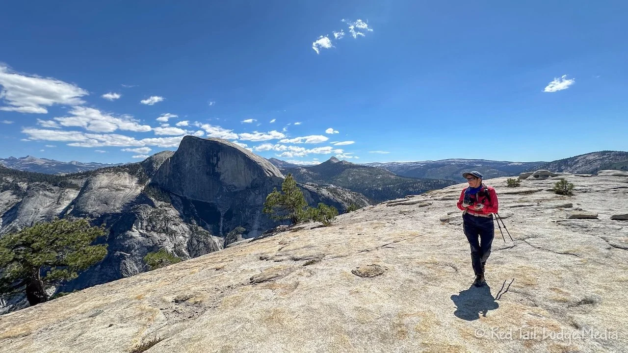
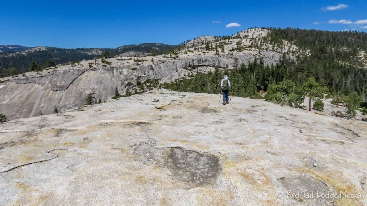
Then the view opens up and we found ourselves on a flat, rocky point. A couple of backpackers were camped there. We could see down into the valley. Was this North Dome? Checking our GPS tracking apps, we realize that it was not. We could see North Dome below us, to the right of Half Dome. We still had a mile and a half to go. We’re pretty sure that people who are not using a GPS tracker might think they had reached the end of the trail and turn around to head back.

As the view from the point drew us out to the end of the outcropping, we missed that the trail had turned, heading down to the left. We retraced our steps and found the trail. There were no trail signs there, just a few small rocks outlining the trail, very subtle.

The trail heads down around the viewpoint, then drops alongside a sheer rock face. This is the most technical part of the whole trail. You scale along some steep rock along a little seam, glad that the tread of your shoes have a good grip. But there isn’t much exposure, so if you do slip and fall, you might get hurt, but you’re not falling off the edge of a cliff. Then it is an easy ascent back up to the top of North Dome.
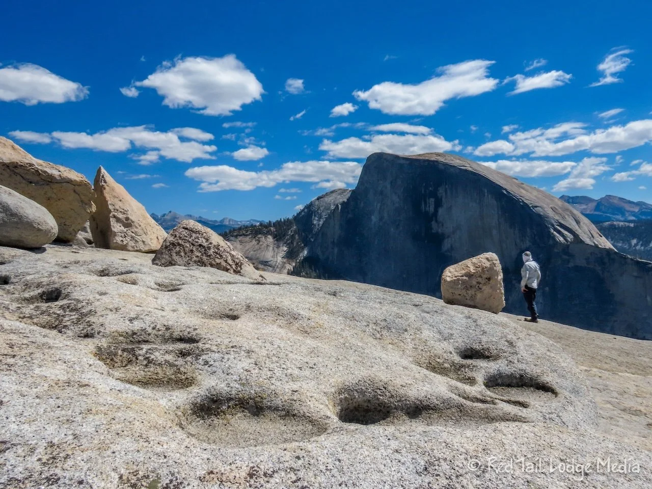
The views from North Dome are spectacular. We’re glad we did this hike after exploring much of the rest of the park, as we could recognize many of the now familiar features from North Dome. In one direction, the Yosemite Valley floor stretches out in front of you. In another, Half Dome is right in your face. Also visible on the south rim is Glacier Point and Sentinel Dome, which we had visited several days earlier. You can’t see Vernal Fall, Nevada Fall, nor Bridalveil Falls from North Dome, but you can see Illilouette Fall up a canyon heading directly to the south.

We sat down and enjoyed our lunches along with the incredible views. We can’t imagine that the views from Half Dome would be much better. And the hike to North Dome is less strenuous, with a lot less people on the trail, and much less dangerous, no permit required.
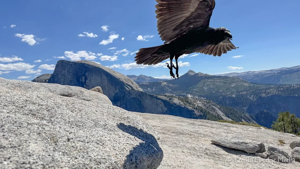
As we sat there, a raven hovered a few feet over our heads for a few minutes. It was the first time we’ve felt uncomfortable and nervous about a raven. It almost seemed like he was deciding whether to attack us or not. Thankfully he moved on.
After climbing down off of North Dome and up the little cliff face, we returned to a trail junction. We could either continue to ascend up the trail, back the way we came, up to the viewpoint, or turn to the left and return on the other two legs of the triangle as the park ranger suggested. Somehow we convince ourselves that although it would add 0.8 miles, it might be less elevation gain since we didn’t have to go back up and over the ridge.

The trail followed along the flat rocks before dropping down the back side. Thank goodness we could see where we were on our AllTrails app, because we had trouble finding where the trail left the rocks. After that, the trail was easy to follow. Before long, we were back on an easy cruising trail.

Although the trail did not go up and over a ridge, it instead went down much further then back up. To our disappointment, it was not less elevation gain but about 200 feet more. And there wasn’t really anything special along the other route to see. So we would recommend doing North Dome as an out-and-back.

By the time we returned to the trailhead, we had gone 10.6 miles with an elevation gain of 2215 feet in five hours and 52 minutes. It was our 59th hike for the year. At the end of the hike, Ann felt better than at the end of our Mist Trail hike a couple of days prior. Keith felt about the same. He did not appreciate the uphill at the end of the North Dome hike. Ann probably felt better because she ate more on the trail than the time before. This time she ate an apple and three granola bars for lunch. For some reason, on the Mist Trail, she only ate an apple and one granola bar. She had more granola bars with her. So by the end of the Mist Trail hike, she was probably low on blood sugar, which is why she felt so exhausted.
On the way back to camp, we stopped at the Crane Flat gas station for an after hike treat of soda and ice cream novelties. They were very refreshing.

We spent Monday in Yosemite Valley again. This time we rode our bikes around the bike path. After parking in the Day Use parking area near Yosemite Lodge again, we got the bikes out. We took the bike path loop in the clockwise direction.

Ann was hungry, so we stopped at Yosemite Village to have lunch at the Yosemite Grill. It’s a fast food place right next to the Welcome Center. We both had the pulled pork with fries. The food was OK. The bun was a little soft, so it was falling apart from the weight and moisture of the pork and sauce. Ann would have also like a little more slaw on the sandwich. There was so little that you could barely taste it.
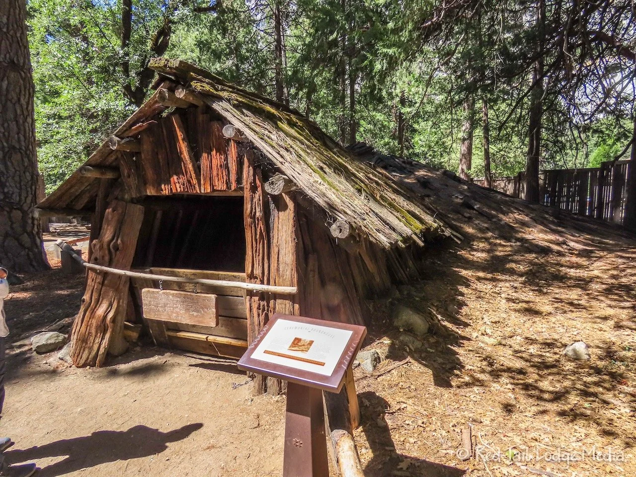
While we were at the Village, we did a little shopping. Keith had broken his coffee mug and Ann’s water bottle was leaking, so we purchased some replacements. Then we checked out the Yosemite Museum and Indian Village. It was interesting to learn about the native Americans in the area, such as the Ahwahnechee, part of the Southern Miwok people. The reconstructed ceremonial roundhouse and the sweathouse are still used by the local American Indian community for ceremonies and special gatherings.
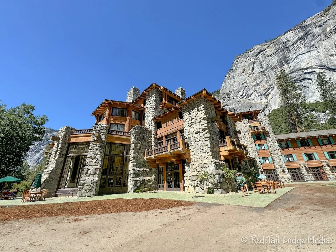
As we continued on our way around the bike path, we stopped to walk over to the Ahwahnee lodge. The bike path does not pass by it, so we saw a walking path over to it on the map. There was no place to park our bikes, so we just chained them to a sign post next to the bike path. We probably could have ridden our bikes over to the lodge, but bikes were not allowed on non-paved paths, so we followed the rules.

Ahwahnee is the grand lodge that we imagined would be in an old national park. The hotel was built in 1927. We walked around the outside of the lodge, then ducked inside the lobby to check it out. Beautiful stain glass windows lined the tops of the large windows surrounding the main lounge area. We took a peak into the dining room with its exposed timbers and simple, but elegant chandeliers.
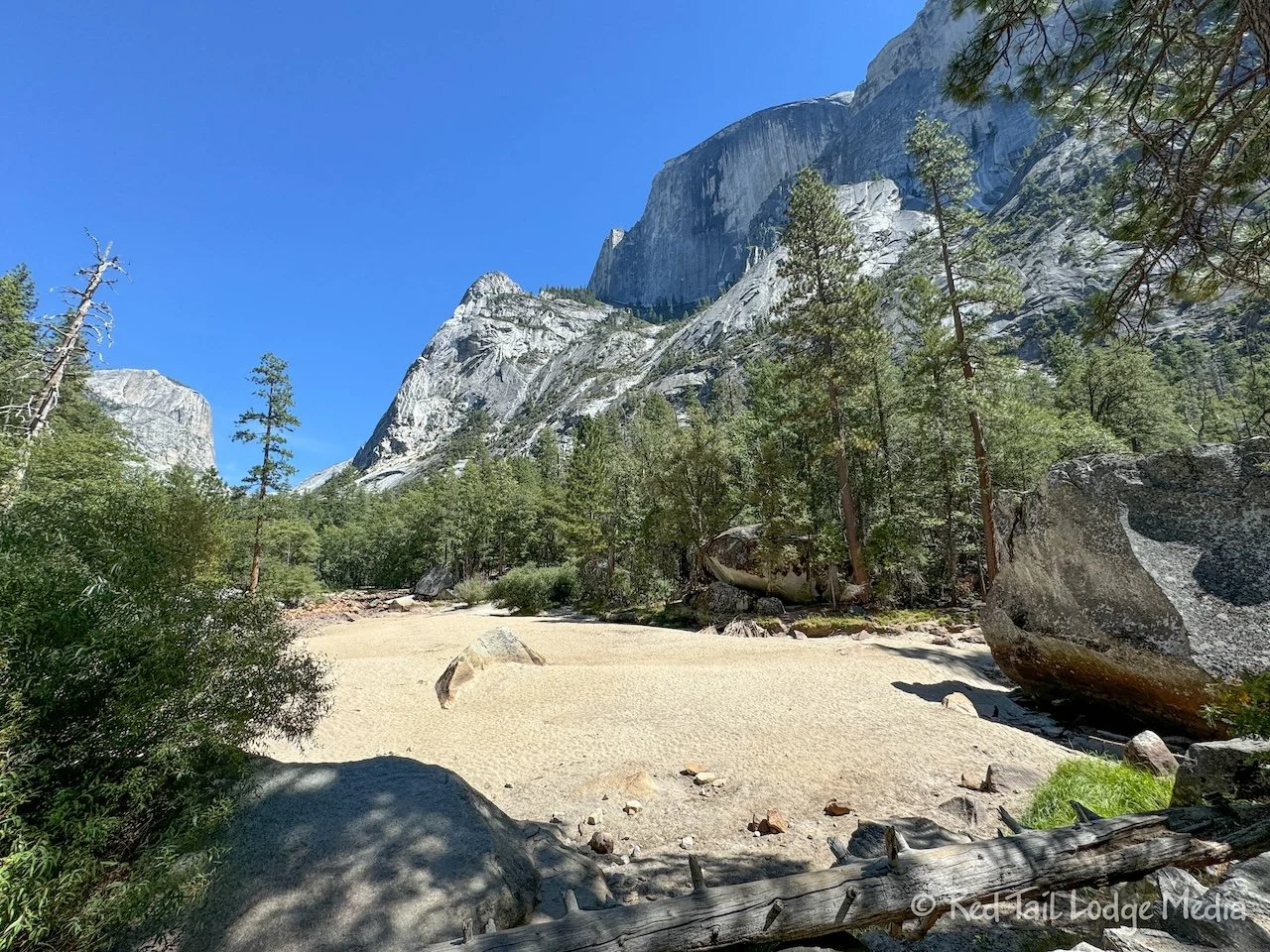
After returning to our bikes, we continued on the bike path to Mirror Lake. Or rather, where Mirror Lake is located earlier in the year. At the beginning of September, it is bone dry. It wasn’t even marshy or wet, just dry sand and rocks.

As we continued on the bike path, we missed a turn and went straight across to Curry Village. We meant to take the outer loop along the road that is only for bikes and pedestrians. Oh well, we walked half of that on our way to and from the Mist Trail several days prior.

At Curry Village, we stopped for a restroom break, drinks and ice cream novelties. Even with some signs indicating which way to the restrooms, we still struggled finding them. We weren’t expecting them to be inside the Camp Curry campground. We followed the bathroom sign and we found ourselves standing in front of the campground office. That didn’t seem right, so we circled around and finally discovered the restrooms hidden behind a couple of other buildings. It was slim pickin’s in the general store. We opted for a couple of ice cream bars. At least they had Coke in addition to Pepsi products. We found a small bench in the shade to savor our treats before getting back on our bikes.

The bike path continued alongside the road. It passed by the Housekeeping Camp, the Yosemite Conservation Heritage Center, and the Yosemite Chapel. Then the bike path crosses the Swinging Bridge to return to the Day Use parking area where we started. The route we took was about seven and a half miles long. If we had not skipped the Happy Isle loop, it probably would have been closer to nine and a half miles.
The bike ride was OK. It did not live up to what we had imagined in our heads. It seemed rather hard to navigate as it was not as clearly marked as we would have liked. There were also quite a few congested areas with lots of pedestrians. In addition to the outer loop, there are several cut-over paths, so we were constantly stopping and pulling out the map to figure out which way we wanted to go. Most of the buildings are tucked away, hidden among the trees, so you couldn’t visually get your bearings.
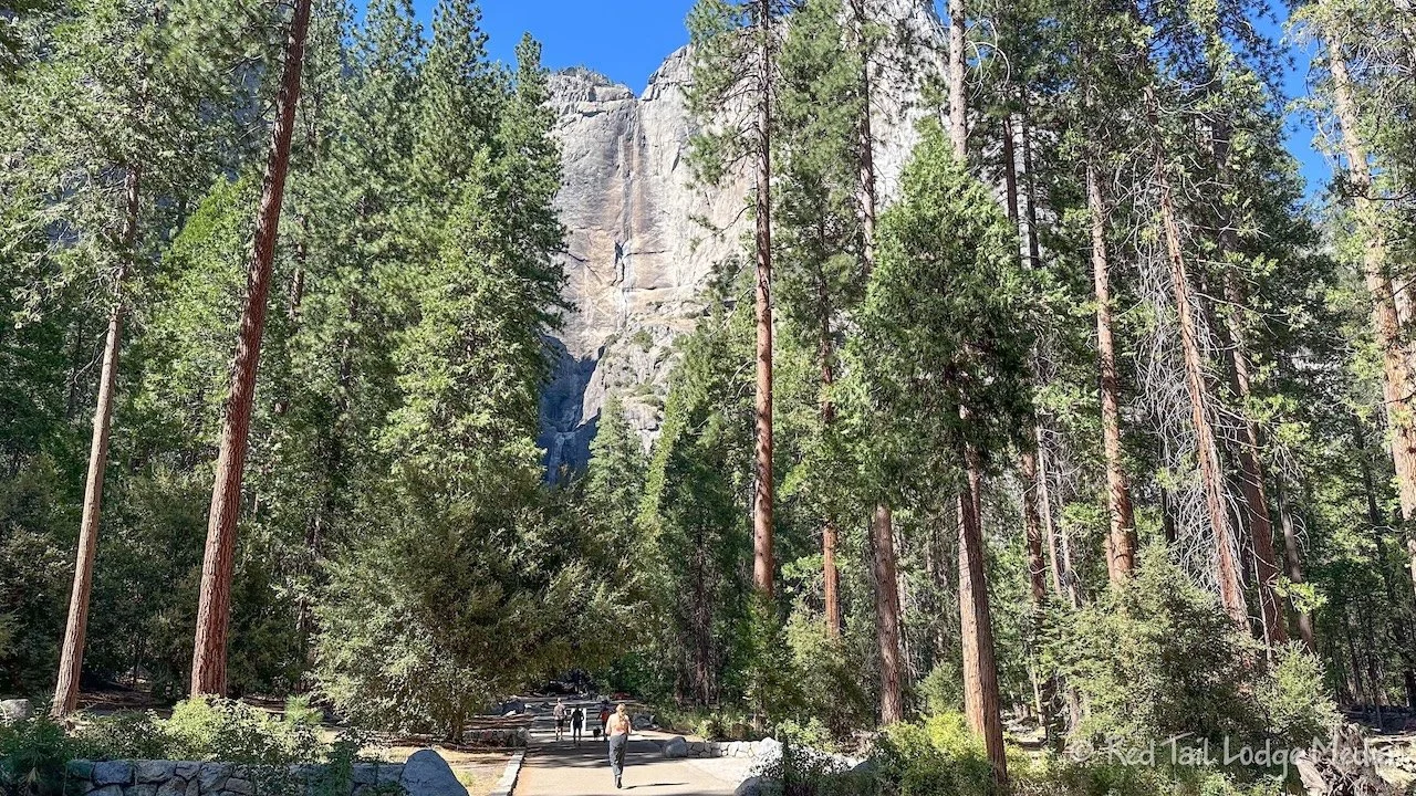
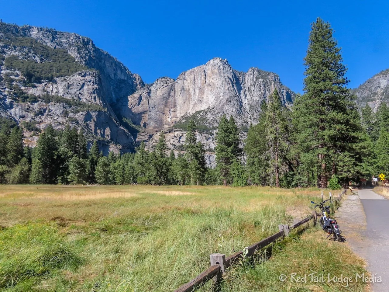
After putting away our bikes, we walked over to the Lower Yosemite Falls. We had skipped that on our bike ride because it was half a mile up a pedestrian only path and Ann was too hungry to delay lunch that long. So instead, we walked it from the parking lot, making it more like a two mile walk. Lower Yosemite Falls is the shorter section, with the Upper Yosemite Falls being the taller section of falls. However, the falls were dry this time of year. In fact, even after walking up pretty close to the falls, you could barely tell there was any water flowing at all. More water flows through a garden hose than what we saw flowing at Yosemite Falls.

On our drive out of Yosemite Valley, we stopped at the El Capitan picnic area. We thought we might have dinner there while watching rock climbers. However, the picnic area is in the trees, so there isn’t much of a view. We did manage to catch a glimpse of two climbers with a bivouac hanging below them. They were so far away, we could only see the bivvy with our naked eyes. It was only when we zoomed in with Ann’s camera or Keith’s binoculars that we could make out the climbers.

Being satisfied with seeing climbers on El Capitan, we drove back to the campground for dinner. Upon arriving, we were informed that there was a water main break, so none of the flush toilets were working. We would need to walk down to the group camping site and use their two vault toilets. It was a rather long walk from our camp site, but getting some more steps in for the day did not hurt us any. We have a toilet in Red Tail, but our five gallon cassette was getting rather full. So we wanted to save what space there was left for the middle of the night. There is no dump station at Hodgdon Meadow. The closest dump is back down in Yosemite Valley, 45 minutes away.
Tuesday was a travel day, from Hodgdon Meadow Campground in Yosemite to Crowley Lake BLM Campground near Mammoth Lakes. However, there was still more of Yosemite to see.

The water was still off at Hodgdon Meadow in the morning, so we got some steps in walking over to the vault toilet and waiting in line. We were surprised how short the line for the bathroom was, considering there were only two operating toilets for the over 100 camp sites. After packing up and hitting the road, we stopped at the Crane Flat gas station at the start of Tioga Road for gas and bathrooms.

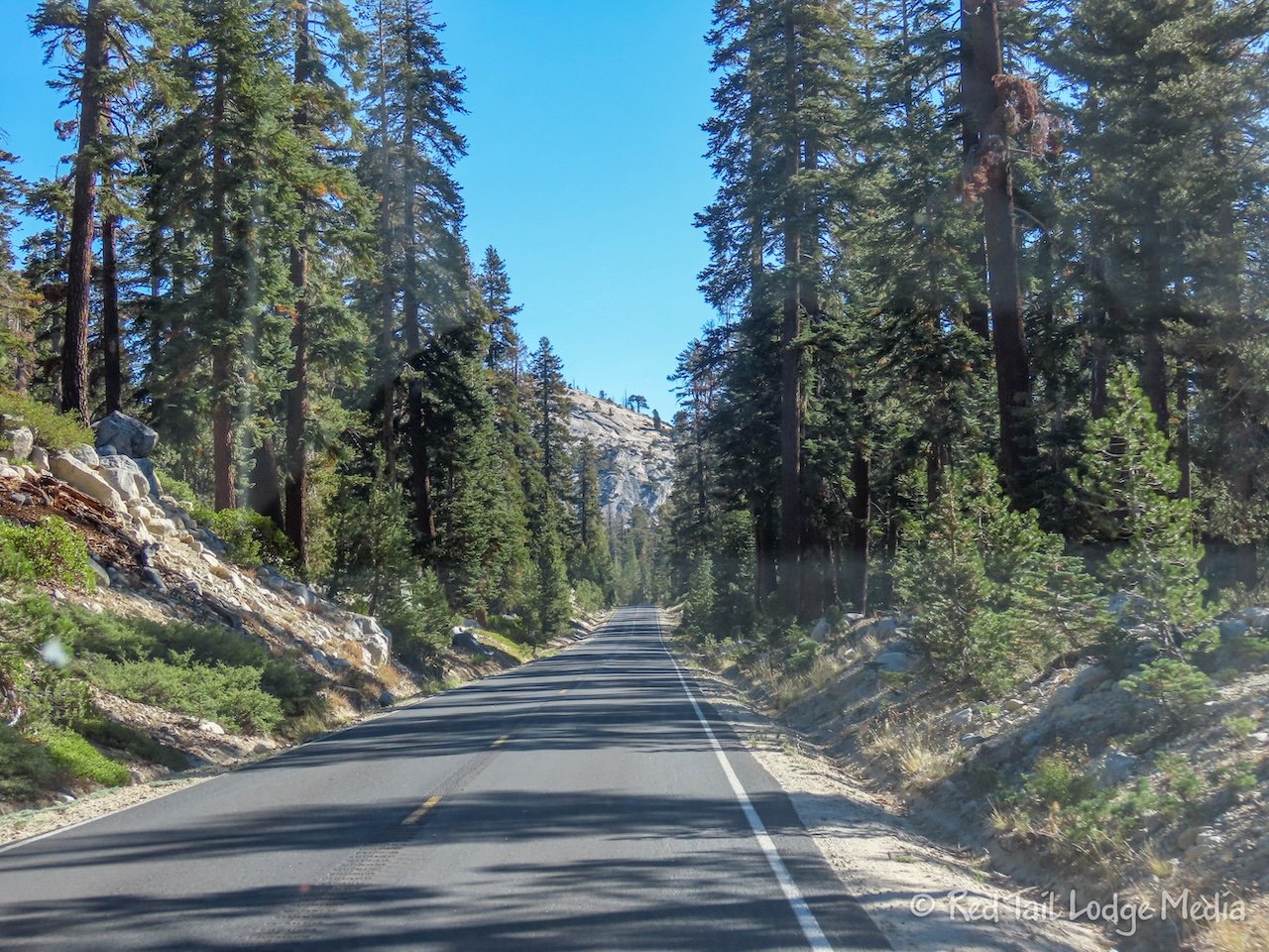
It was a beautiful drive on Tioga Road out the Tioga Pass Entrance of Yosemite, to the east. As we passed by the Porcupine Creek trailhead, where we hiked a couple of days prior, there were still open spots left at a little past 9 am.

The scenery was beautiful, but nothing too special until we approached Olmsted Point. Then the landscape abruptly changed to be very stunning. From Olmsted Point, you could see Half Dome in the distance. Granite, stony mountain peaks surround you. A few lakes reflect the peaks in their clear water.

At Tuolumne Meadows, the landscape opens up to a large glacier moraine. We stopped at the small Tuolumne Meadows Visitor Center to stretch our legs. Inside the cozy wooden building was a fire burning in a wood stove.

Then Tioga Road goes over Tioga Pass. We thought it would be steeper and more twisting than it was. Before we knew it, we were at the entrance station, without even realizing we were at the summit. But the gorgeous scenery did not stop there. It continued as the road descends quickly down to highway 395.

And so ended our visit to Yosemite National Park. Would we come back? Probably, but we think we might skip the crowded Yosemite Valley next time and explore more of the park along Tioga Road. Of course, if it is your first time in the park, we definitely recommend seeing Yosemite Valley, even with all of the people. It is hard to take your eyes off of the iconic Half Dome. But we would also recommend spending some time in other parts of the park as well, getting away from some of the crowds.
Check out our related video: Yosemite National Park - North
(Ann)